VISITOR MAP

Free Free Free Free ~
Get a Voki now!

~ Photo ~ STATES WEVE CACHED in
visited 2 states (4%)
Create your own visited map of The United States ~ ~ ~ ~ ~ this is the OFFICIAL CraMicDan GEO-CACHING blog/journal. in this blog youll read about the adventures taken on by CraMicDan in the attempt to locate and find "caches" hidden by other GEO-CACHERS weather it be local to the home coordinats, or while traveling to other destinations. it is also the blog of CraMicDan's own hidden CACHES left for other adventurers to find. for more information on this GPS (Global Positioning System) Hobby, for one or any number of ppl to be a part of you can go to this link: www.geocaching.com. in here we will post notes left by geo-cahers, images left, trinkets left, containers, map locations, and coordinates for those "caches" we find, and those we hid for others. so, if you were lucky enough to find a disposable camera left by CraMicDan in a cache, and you took a picture of yourself and or your group..be looking to return here to see yourself in the blog! good luck and good hunting! CraMicDan ~
Visitor
Create your own visitor map!
~

Total Pageviews

Tuesday, May 23, 2000

GLOSSERY TERMS FOR GEOCACHING


Glossary
================

The Geocaching.com glossary is always changing. If you have any additions, contact us.
contact@geocaching.com;
archive
------------------
This is usually seen when you own a cache. Archiving is basically deleting your cache from the listings on the web site. This usually occurs when you are not going to replace a cache after it has been removed. You can temporarily disable it as the cache owner if you plan to activate it again within a month.

benchmark
----------------------------
See benchmark hunting for more details.
http://www.geocaching.com/mark/

Bureau of Land Management (BLM)
------------------------------------
The Bureau of Land Management (BLM), an agency within the U.S. Department of the Interior, administers 262 million acres of America's public lands, located primarily in 12 Western States. The BLM sustains the health, diversity, and productivity of the public lands for the use and enjoyment of present and future generations. Their web site is www.blm.gov .

CITO
------------
Cache In Trash Out - When out geocaching, take a bag with you and pick up trash along the way! More info can be found on the Cache In Trash Out page .
http://www.cacheintrashout.org/

cache
-------------------
Pronounced "cash" - In geocaching it is a hidden container filled with a log book and pencil/pen, and possibly prizes. Caches were often used by explorers, miners, etc. to hide foodstuffs and other items for emergency purposes. People still hide caches of supplies today for similar reasons.
Geocaching comes from the terms "geo" and "cache" to explain the sport. Some caches have cash in them, but there is no pun intended :)

datum
------------
A datum is something used as a basis for calculating and measuring. In the case of GPS, datums are different calculations for determining longitude and latitude for a given location.
Currently, Geocaching uses the WGS84 datum for all caches. Many maps still use NAD27, which can cause confusion if your GPS unit is set to NAD27. Always check your GPS to ensure that WGS84 is the datum before entering a cache coordinate into your unit.

FTF
----------
First To Find. Usually found in the forums or written in the online or physical log books.

Geomuggle
------------------
A non-geocacher. Based on "Muggle" from the Harry Potter series, which is a nonmagical person. Usually this term is used after a non geocacher looks puzzled at a geocacher making circles with their GPS receiver, or when a non-geocacher accidentally finds a cache. Geomuggles are mostly harmless.

GPS
------------
GPS stands for Global Positioning System. It is a system of satellites that work with a GPS receiver to determine your location on the planet.
Geocaching uses GPS to help hide and seek caches on the planet. For more information on GPS, visit Trimble's web site .
http://www.trimble.com/gps/index.shtml

GPSr
--------------
Slang for a GPS receiver. Equipment to receive GPS signals for use in navigation.

hitchhiker
---------------------
A hitchhiker is an item that is placed in a cache, and has instructions to travel to other caches. Sometimes they have logbooks attached so you can log their travels. A Travel Bug is an example of a hitchhiker.
http://www.geocaching.com/track/
latitude
-----------------
Latitude and longitude create a waypoint. Latitude is the angular distance north or south from the earth's equator measured through 90 degrees. (Listen to this mp3 http://www.acme.com/jef/singing_science/long_lat-32.MP3 for an entertaining way to learn about longitude and latitude (thanks to ACME ))
http://www.acme.com/jef/singing_science/

letterbox(ing)
----------------------
Letterboxing is similar to Geocaching, but you use a series of clues to find a container. Once you find the container (or letterbox), you take a carved stamp from the box and stamp your personal logbook. You then take your carved stamp and stamp the letterbox's log book. See Letterboxing North America for more info.
http://www.letterboxing.org/

longitude
------------------
Latitude and longitude create a waypoint. Longitude is the angular distance measured on a great circle of reference from the intersection of the adopted zero meridian with this reference circle to the similar intersection of the meridian passing through the object. (Listen to this mp3 http://www.acme.com/jef/singing_science/long_lat-32.MP3 for an entertaining and non-technical way to learn about longitude and latitude (thanks to ACME ))
http://www.acme.com/jef/singing_science/

Markwelled
------------------
When a response to a new post in the forums points you to a similar topic in the past. Based on the user Markwell .
http://www.geocaching.com/profile/?A=5518

NAD27
---------------
Stands for North American Datum 1927. The precursor to WGS84. Many maps still use the NAD27 datum , so always check before using a GPS unit with a map.

spoiler
----------------
A spoiler is information that can give details away and ruin the experience of something. For example, telling someone the end of a movie before they see it. In geocaching, a spoiler gives away details of a cache location and can ruin the experience of the hunt.

TFTC
-------------
Thanks for the cache!
TFTH
-------------
Thanks for the hunt!
TNLN
------------
Took Nothing. Left Nothing. Usually found in cache logbooks for folks that enjoy the thrill of the hunt more than the material contents of the cache.
TNLNSL / TNSL
----------------------
Took Nothing. Left Nothing. Signed Logbook / Took Nothing. Signed Logbook

Travel Bug
--------------------
A Travel Bug is a hitchiker. Visit the travel bug page to learn more about it.
http://www.geocaching.com/track/

USDA Forest Service (USFS)
---------------------------------------
The U.S. Forest Service, an agency within the Department of Agriculture, administers 191 million acres (77.3 million hectares) of National Forests, Grasslands, and Prairies. These public lands are generally geocaching-friendly, with exceptions of designated Wilderness Areas, and other specially designated botanical, wildlife, and archaeological sites. The phrase "Caring for the land and serving people" captures the Forest Service mission of achieving quality land management under the sustainable multiple-use concept to meet the diverse needs of people. The Information Center in the agency's national headquarters has been a Washington D.C. Virtual Geocache since August 12, 2001.
http://www.geocaching.com/seek/cache_details.aspx?ID=5632

Virtual (cache)
------------------------
Adapted from "Virtual Reality," virtual means "nothing there." So a virtual cache means there is no cache container. It's the location that is the cache itself. Nothing is normally traded, except photos and experiences.

WAAS
---------------
WAAS stands for Wide Area Augmentation System, but that doesn't really describe what it is. Garmin has an excellent description on WAAS .
http://www8.garmin.com/aboutGPS/waas.html

watch list
--------------
A watch list is a list of users that are watching a specific travel bug or cache. On some cache pages there is a number of users watching the cache. There is no current functionality to see who those people are.
waypoint
------------------
Waypoints are named coordinates representing points on the surface of the Earth.
Geocaching uses a suggested waypoint for a cache, created automatically when a cache has been created. We generate a waypoint "GC Code" based on the ID of the cache. It is optional, but makes it easier to locate a cache on the geocaching web site.
WGS84
The most current geodetic datum used for GPS is the World Geodetic System of 1984 (WGS84). The significance of WGS84 comes about because GPS receivers rely on WGS84.
Geocaching uses the WGS84 datum by default. We also use the format HDDD MM.MM, which is a standard for GPS receivers (like the eTrex).
HDD means Hemisphere and degrees. MM.MM are minutes in decimal format. If you have any questions, you can either visit the forums
http://forums.groundspeak.com/
or contact us directly .
contact@geocaching.com
It is critical that the format is correct, otherwise cachers will be unable to find your cache!
www.geocaching.com

CACHE LISTING REQUIREMENTS & GUIDELINES


Cache Listing Requirements/Guidelines


============================================
Guidelines last updated February 21, 2007
------------------------------------------------
These are listing guidelines only.
Before a cache is published on the website, a volunteer will review the page for inaccuracies, bad coordinates, and compliance with these guidelines. The physical cache site is not verified. As the cache owner, you are responsible for the placement and care of your cache.
Prior to placing and submitting a cache you are expected to review the following guidelines. I
n order to post a new cache and submit it for review you must indicate that you have read the guidelines as required.
Geocaching is a constantly changing and evolving sport, and as a result these guidelines are subject to change as the sport progresses.
Please refer back to these guidelines prior to cache placement to ensure that no changes have been implemented that would adversely affect your planned cache placement.
First and foremost please be advised there is no precedent for placing caches.
This means that the past listing of a similar cache in and of itself is not a valid justification for the listing of a new cache.
If a cache has been published and violates any guidelines listed below, you are encouraged to report it.
However, if the cache was placed prior to the date when a guideline was issued or updated the cache is likely to be “grandfathered” and allowed to stand as is.
If you believe that your cache may be questionable, you are encouraged to add a note to the cache page.
For example, you could add an explanation in the “notes to reviewer” section such as: "The train tracks running through this park are inactive and have been converted to a rails-to-trails path."
The reviewer will read the note and take the information into consideration.
Rest assured that notes to reviewers will be removed before the caches are published. Most caches that are temporarily put on hold or archived are done so due to a lack of information.
Having all the relevant information up front during the review process will help ensure a speedy listing.

If your cache has been placed on hold, temporarily disabled or archived…
---------------------------------------------------------------------------------
First please read the reviewer notes for an explanation.
It is a common practice for the reviewers to place a cache on hold while they obtain additional details required for it to be published.
A reviewer may temporarily disable a submission to provide time for the cache owner to make necessary changes to the cache placement or cache description.
This doesn't necessarily mean that it won't be published.
In order to ensure a prompt response when responding to a reviewer, please follow the contact instructions given by the reviewer in their note.
If no other instructions are provided, click on the volunteer reviewer's profile from the cache page and e-mail the reviewer through Geocaching.com.
If you reply directly to the automated cache notification address, most likely you will not receive a reply.
If your cache has been archived and you wish to appeal the decision, first contact the reviewer and explain why you feel your cache meets the guidelines.
Exceptions may sometimes be made, depending on the nature of a cache.
If you have a novel type of cache that “pushes the envelope” to some degree, then it is best to contact your local reviewer and/or Groundspeak before placing and reporting it on the Geocaching.com web site.
The guidelines should address most situations, but Groundspeak administrators and reviewers are always interested in new ideas.
If, after exchanging emails with the reviewer, you still feel your cache has been misjudged, your next option is to ask the volunteer to post the cache for all of the reviewers to see in their private discussion forum.
Sometimes a second opinion from someone else who has seen a similar situation can help in suggesting a way for the cache to be published.
Next, you should feel free to post a message in the “Geocaching Topics” section of the Groundspeak Forums to see what the geocaching community thinks.
If the majority believes that it should be published, then Groundspeak administrators and volunteers may review the submission and your cache may be unarchived.
Finally, if you believe that the reviewer has acted inappropriately, you may send an e-mail with complete details, waypoint name (GC****) and a link to the cache, to Groundspeak's special address for this purpose: appeals@geocaching.com.
For all other purposes, whenever these Guidelines ask the cache owner to “contact Groundspeak,” use the contact@geocaching.com e-mail address.
Table of Contents
-----------------------------------
Off-limit (physical) caches
Cache Types
Cache Sizes
Traditional Caches
Multi-Caches
Mystery or Puzzle Caches
Letterbox Hybrid
Earthcaches
Event Caches
Mega-Event Caches
CITO Event Caches
Guidelines that apply to all cache types
---------------------------------------------
Cache Maintenance
Cache Permanence
Cache Saturation
Cache Contents
Commercial Caches
Caches that Solicit

Grandfathered Cache Types
Virtual Caches
Webcams

Guidelines that apply to grandfathered cache types
Virtual Cache and Webcam Cache Maintenance Guidelines
Virtual Cache Logging Guidelines
Webcam Cache Logging Guidelines
Off-limit (Physical) Caches
------------------------------------------------
By submitting a cache listing, you assure us that you have adequate permission to hide your cache in the selected location.
However, if we see a cache description that mentions ignoring "No Trespassing" signs (or any other obvious issues), your listing may be immediately archived.
We also assume that your cache placement complies with all applicable laws.
If an obvious legal issue is present, or is brought to our attention, your listing may be immediately archived.
Caches may be quickly archived if we see the following (which is not inclusive):
* Caches on land managed by an agency that prohibits geocaches, such as the U.S. National Park Service or U.S. Fish and Wildlife Service (National Wildlife Refuges)
* Caches that are buried. If a shovel, trowel or other “pointy” object is used to dig, whether in order to hide or to find the cache, then it is not appropriate.
* Caches that deface public or private property, whether a natural or man-made object, in order to provide a hiding place, a clue or a logging method.
* Caches placed in areas which are highly sensitive to the extra traffic that would be caused by vehicles and humans (examples may include archaeological or historic sites).
* Caches hidden in close proximity to active railroad tracks. In general we use a distance of 150 ft (46 m) but your local area's trespassing laws may be different. All local laws apply.
* Caches near or on military installations.
* Caches near, on or under public structures deemed potential or possible targets for terrorist attacks. These may include but are not limited to highway bridges, dams, government buildings, elementary and secondary schools, and airports.
There may be some exceptions.
If your cache fits within one of the above areas, please explain this in a note to the reviewer.
If you are given permission to place a cache on private property, indicate this on the cache page for the benefit of both the reviewer and people seeking out the cache.
In addition, there may be local regulations already in place for certain types of parks in your region (state parks, county preserves, etc.).
There are many local caching organizations that would be able to help you out with those regulations.
If your area does not have a local caching organization please contact your local reviewer for information on regulations.
If you have complied with special regulations by obtaining a permit, please state this on your cache page or in a 'note to the reviewer'.
A reviewer may request that you provide contact information for the person who gave you permission to hide your cache.
If the Geocaching.com web site is contacted and informed that your cache has been placed inappropriately, your cache may be archived or disabled and you may be contacted with any information provided by the individual or organization who contacted us.

Cache Types
-------------------
Cache Sizes
Cache sizes for all caches that have a physical container.
* Micro (35 mm film canister or smaller – less than approximately 3 ounces or .1 litres -- typically containing only a logbook)
* Small (Sandwich-sized Tupperware-style container or similar -- less than approximately 1 quart or litre -- holds trade items as well as a logbook)
* Regular (Tupperware-style container or ammo can)
* Large (5 gallon/20 litre bucket or larger)

Traditional Caches
-------------------------
This is the original cache type consisting of (at a bare minimum) a container and a logbook.
The cache may be filled with objects for trade.
Normally you'll find a Tupperware-style container, ammo box, or bucket filled with goodies, or smaller container ("microcache") too small to contain items except for a logbook.
The coordinates listed on the traditional cache page are the exact location of the cache.
A container with just an object or codeword for verification, and no logbook, generally, does not qualify as a traditional cache.
Caches that require the geocacher to do something beyond finding the container and signing the logbook generally do not qualify as traditional caches.

Multi-Caches
----------------------
There are many variations to multi-stage caches.
The most common is that in which the first container or waypoint contains or provides coordinates to the next location.
Another popular variant is a series of multiple waypoints, each of which provide partial coordinates for the final cache's position.
Please provide the coordinates of all stages of the multicache.
The posted coordinates are for the first stage.
Use the “Additional Waypoints” feature when submitting the multi-cache coordinates for the other stages.
If you don't want the coordinates for the rest of the stages displayed, be sure to mark them as “hidden”.
Doing this will hide the coordinates from view by anyone except the owner and website volunteers.
Offset caches are a variation on multi-caches.
They are listed as a multi-cache when selecting a cache type.
They are not found by simply going to some coordinates and finding a cache there.
With the offset cache the published coordinates could be of an existing historical monument, plaque, or even a benchmark that you would like to have your cache hunter visit.
At this spot, the hunter looks for numbers or information already appearing on the marker or on some part of the marker or site (geocachers NEVER deface public or private property).
The geocacher is then able to manipulate these numbers or information using instructions posted on the cache page to continue the hunt.

Mystery or Puzzle Caches
-----------------------------
The “catch-all” of cache types, this form of cache often involves complicated puzzles that you will first need to solve in order to determine the coordinates.
The information needed to solve the puzzle must be available to the general caching community and the puzzle should be solvable from the information provided on the cache page.
For example, a puzzle that requires research on public websites in order to determine the coordinates may be acceptable, while a puzzle that requires sending an e-mail to the cache owner with the solution in order to obtain the coordinates may not be.
For many caches of this type, the coordinates listed are not of the actual cache location but a general reference point, such as a nearby parking location.
Unless a good reason otherwise can be provided, the posted coordinates should be no more than 1-2 miles (2-3 kilometres) away from the true cache location.
This allows the cache to show up on the proper vicinity searches and to keep the mileage of Trackables that find their way into the cache reasonably correct.
Caches with mandatory requirements in addition to signing the logbook should be listed as mystery caches.
Examples include sending the cache owner a verification codeword found inside the logbook, performing some task at the cache location and taking a photograph, or writing the online log in a format or with content that satisfies the cache requirements.
The mystery cache designation assists finders in identifying that something extra is required in order to log a find.
If you choose to submit a cache of this type please give as much detailed information as possible to the reviewer when you submit the cache.
Report the coordinates for the actual cache location and any other relevant stages or clues using the “Additional Waypoints” feature.
The reviewer may still need more information before publishing the cache. Please cooperate with these requests.

Letterbox Hybrid
-------------------------
Letterboxing is another form of treasure hunting that uses clues to direct hunters to a hidden container.
Each letterbox contains a stamp which is the signature for that box. Most letterboxers have their own personal stamps and personal logbooks.
They stamp the letterbox logbook with their personal stamp, and use the stamp contained in the letterbox to “sign” their personal logbook.
Letterbox hybrids are a mixture of letterbox and geocache.
They should contain a signature stamp that stays with the box, and they must conform to the guidelines for geocaches and therefore must contain a logbook and involve GPS use as an integral part of the hunt.
A letterbox hybrid cannot be designed to be found using only clues.
Whether or not the letterbox hybrid contains trade items is up to the owner.
In most cases personal stamp and personal logbook are not necessary to be a seeker of a letterbox hybrid.

Event Caches
----------------------
Event caches are gatherings that are open to all geocachers and which are organized by geocachers.
While a music concert, a garage sale, an organized sporting event, a ham radio field day or a town's fireworks display might be of interest to a large percentage of geocachers, such events are not suitable for submission as event caches because the organizers and the primary attendees are not geocachers. In addition, an event cache should not be set up for the sole purpose of drawing together cachers for an organized hunt of another cache or caches. Such group hunts are best organized using the forums or an email distribution list.
For geocaching events that involve several components, such as a full weekend event that includes a geocoin trading session, a seminar and a potluck dinner, multiple event listings may be submitted if they each stand on their own merits as events meeting the listing guidelines.
Event caches should be submitted no less than two weeks prior to the date of the event, so that potential attendees will have sufficient notice to make their plans. Events are generally published no more than three months prior to the date of the event, to avoid having the listing appear for a prolonged period of time on the nearest caches page and in the weekly e-mail notification of new caches.
Exceptions are sometimes made for events that are designed to attract a regional, national or international group of geocachers, or if an overnight stay is expected as part of the event, requiring advance reservations and travel planning (for example, a campout).
Contact your reviewer if you wish to set up such an event, which may be published up to six months prior to the event date.
After the event has passed, the event cache should be archived by the organizer within four weeks.

Mega-Event Caches
---------------------------------
Mega-Events are a special designation reserved for only the largest event caches – those which attract geocachers to attend on a regional, national or international level.
To qualify as a Mega-Event, the organizers must obtain prior approval from Groundspeak – not from their volunteer cache reviewer.
Among other requirements, the organizers must demonstrate a substantial likelihood that at least 500 people will attend the event.
A Mega-Event Cache may be published up to one year prior to the event date.
A regular Event Cache can be changed to a Mega-Event Cache after the fact, if the organizers demonstrate to Groundspeak that more than 500 people attended.

CITO Event Caches
---------------------------
The idea of Cache In Trash Out (CITO) came about late in the year 2000 as a way for geocachers to contribute to the beautification of our local parks and lands.
You may find more information about the CITO program at http://www.cacheintrashout.org.
The CITO event cache category was added to differentiate cleanup events from other types of event caches.
Use this category when you are asking geocachers to show up on a particular day to pick up litter at a park, remove piles of junk near a popular waterfront, etc.
Do NOT use this category for a physical cache that is placed in an area that is need of cleanup – just mention the CITO opportunity on your cache page.
CITO Events are set up and sponsored by geocachers – not by other organizations.
If you have an event you feel fits within the spirit of this unique category, yet are still unsure, please seek permission from Groundspeak before submitting.

Earthcaches
-----------------
This is a unique but limited cache type.
An Earthcache is an educational site that people can visit to view a unique geoscience feature on-the-ground.
All Earthcaches must be submitted and approved through the Geological Society of America – the regional Groundspeak volunteer cache reviewers have no involvement with Earthcache listings.
The Earthcache submittal form and Guidelines may be found on the Earthcache.org site. http://www.earthcache.org/
Logging an Earthcache find requires compliance with the requirements stated by the owner and the Earthcache Website, including answering the required questions by e-mail to the owner, providing original photos if so requested, etc.

Guidelines that Apply to all Cache Types
-------------------------------------------------
For all physical caches and waypoints, think carefully about how your container and the actions of geocachers will be perceived by the public.
For example, a cache hidden in full view of office or apartment building windows exposes a geocacher to being seen by someone who may think the cache search looks suspicious.
Your cache may be hidden on public property, but there may be concerned residents on the other side of that property line.
And, while an ammo box or PVC pipe may be a great container if hidden deep in the woods, it may cause alarm if discovered in an urban setting.
A clear plastic container or a microcache may be a better choice.
In busy areas, avoid containers that look suspicious, including attachment materials like wires or tape.
To reduce confusion and alarm when a cache is discovered accidentally, clearly label your container on the outside with appropriate information to say it is a geocache. Cover over any military markings with paint or a geocache sticker. Include an explanatory “stash note” inside your cache.
Common sense in selecting hiding spots and containers can reduce the risk of your cache being perceived as a danger to those who are unaware of our sport.
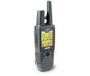
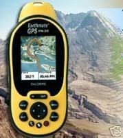
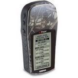
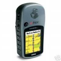
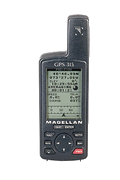
You as the owner of the cache must visit the site and obtain the coordinates with a GPS.
GPS usage is an essential element of geocaching.
Therefore, although it is possible to find a cache without a GPS, the option of using accurate GPS coordinates as an integral part of the cache hunt must be demonstrated for all physical cache submissions.
For all physical caches, there must be a logbook, scroll or other type of log for geocachers to record their visit.
For all caches that include multiple waypoints please report all the additional coordinates using the “Additional Waypoints” feature.
If you don't want a set of coordinates displayed on your cache page, be sure to mark them as “hidden”.
Doing this will hide the coordinates from view by anyone except the owner and website volunteers.
In the interest of file security, caches that require the downloading, installing or running of data and/or executables may not be published.
Caches that require a geocacher to visit another website will not be published if the finder must create an account with, or provide personal information to, the other website.
If you are placing a large number of caches to be published on the same date (for example, on the day of an event cache), please submit the cache pages for all of the caches at least ten days in advance of the release date.
Leave a “note to reviewer” indicating that the cache is to be released on the date specified. This allows your reviewer adequate time to review the submissions or to arrange for help from another reviewer.
(Note: Caches placed in connection with an event must be placed with the intention of leaving them in place after the event, temporary caches are not accepted.)
Your cache should be in place and ready to hunt at the time your cache page is submitted for review.
If for any reason it is not ready, please either disable your cache page so that it won't be seen by the reviewer until ready, or include a “note to reviewer” to explain your special circumstances (for example, waiting for a permit from a land manager).
At times a cache may meet the listing requirements for the site but the reviewers, as experienced cachers, may see additional concerns that you as a cache placer may not have noticed.
As a courtesy, the reviewer may bring additional concerns about cache placement to your attention and offer suggestions before posting.
But as the cache owner you are responsible for placement and care of your cache. Note: Exceptions to the listing guidelines may occasionally be made depending on the novel nature and merits of a cache.
If you have a cache idea you believe is novel, contact Groundspeak before placing and reporting it on the Geocaching.com web site.

Cache Maintenance
---------------------------------
The cache owner will assume all responsibility of their cache listings.
The responsibility of your listing includes quality control of posts to the cache page.
Delete any logs that appear to be bogus, counterfeit, off topic, or not within the stated requirements.
As the cache owner, you are also responsible for physically checking your cache periodically, and especially when someone reports a problem with the cache (missing, damaged, wet, etc.).
You may temporarily disable your cache to let others know not to hunt for it until you have a chance to fix the problem. This feature is to allow you a reasonable time – normally a few weeks – in which to arrange a visit to your cache.
In the event that a cache is not being properly maintained, or has been temporarily disabled for an extended period of time, we may archive or transfer the listing.
It may be difficult to fulfill your maintenance obligations if you place a cache while traveling on vacation or otherwise outside of your normal caching area. These caches may not be published unless you are able to demonstrate an acceptable maintenance plan. It is not uncommon for caches to go missing, areas to be cleared, trails to be blocked or closed, objects used for multi-cache or puzzles to be moved or removed, etc.
Your maintenance plan must allow for a quick response to reported problems.
The territory in which a geocacher is able to maintain caches responsibly will vary from one person to the next.
An active geocacher who regularly visits areas hundreds of miles apart can demonstrate their ability to maintain a cache 100 miles from home.
A geocacher whose previous finds and hides are all within 25 miles of their home would likely not see their cache published if placed 250 miles away from their home.
If you have special circumstances, please describe your maintenance plan on your cache page. For example, if you have made arrangements with a local geocacher to watch over your distant cache for you, that geocacher's name should be mentioned on your cache page.

Cache Permanence
-----------------------------
When you report a cache on the Geocaching.com web site, geocachers should (and will) expect the cache to be there for a realistic and extended period of time.
Therefore, caches that have the goal to move (“traveling caches”), or temporary caches (caches hidden for less than 3 months or for events) most likely will not be published.
If you wish to hide caches for an event, bring printouts to the event and hand them out there.
We realize that it is possible that a planned long-term cache occasionally becomes finite because of concerns with the environment, missing or plundered caches, or the owner's decision to remove the cache for other valid reasons.
Please do your best to research fully, hide wisely, and maintain properly for a long cache life.

Cache Saturation
------------------------
The reviewers use a rule of thumb that caches placed within .10 miles (528 feet or 161 metres) of another cache may not be published on the site.
This is an arbitrary distance and is just a guideline, but the ultimate goal is to reduce the number of caches hidden in a particular area and to reduce confusion that might otherwise result when one cache is found while looking for another. On the same note, don't go cache crazy and hide a cache every 600 feet just because you can.
If you want to create a series of caches (sometimes called a “Power Trail”), the reviewer may require you to create a multi-cache, if the waypoints are close together. A series of caches that are generally intended to be found as a group are good candidates for submission as a single multicache.
The cache saturation guideline applies to all physical stages of multicaches and mystery/puzzle caches, as well as any other stages entered as “stages of a multicache.”
The guideline does NOT apply to event caches, earthcaches, grandfathered virtual and webcam caches, stages of multicaches or puzzle caches entered as “question to answer” or “reference point,” or to any “bogus” posted coordinates for a puzzle cache.
Within a single multicache or mystery/puzzle cache, there is no minimum required distance between waypoints.

Cache Contents
------------------------
Use your common sense in most cases.
Explosives, fireworks, ammo, lighters, knives (including pocket knives and multi-tools), drugs, alcohol or other illicit material shouldn't be placed in a cache. As always respect the local laws. Geocaching is a family activity and cache contents should be suitable for all ages.
Food items are ALWAYS a BAD IDEA.
Animals have better noses than humans, and in some cases caches have been chewed through and destroyed because food items (or items that smell like food) are in the cache.
Even the presence of mint flavored dental floss has led to destruction of one cache.
If the original cache contents list any of the above items or other questionable items, or if a cache is reported to have the questionable items, the cache may be disabled, and the owner of the cache will be contacted and asked to remove the questionable items before the cache is enabled.

Commercial Caches
----------------------
Commercial caches attempt to use the Geocaching.com web site cache reporting tool directly or indirectly (intentionally or non-intentionally) to solicit customers through a Geocaching.com listing.
These are NOT permitted. Examples include for-profit locations that require an entrance fee, or locations that sell products or services.
o2pIf the finder is required to go inside the business, interact with employees, and/or purchase a product or service, then the cache is presumed to be commercial.
Some exceptions can be made.
In these situations, permission can be given by Groundspeak.
However, permission should be asked first before posting.
If you are in doubt, ask first. If you do not have advance permission, your reviewer will refer you to Groundspeak.

Caches that Solicit
------------------------------
Solicitations are off-limits.
For example, caches perceived to be posted for religious, political, charitable or social agendas are not permitted.
Geocaching is supposed to be a light, fun activity, not a platform for an agenda.

Grandfathered Cache Types
-------------------------------
Cache types that are listed below are no longer available as options for new listings on Geocaching.com.
Cache descriptions and maintenance guidelines are listed below. Grandfathered caches that are not maintained may be archived.
Not to worry, there is a separate website provided by Groundspeak Inc. dedicated to marking these unique locations. Please visit waymarking.com for details.

Virtual Caches
---------------------------
A virtual cache is an existing, permanent landmark of a unique nature.
The seeker must answer a question from the landmark and verify to the cache owner that he was physically at the location.

WebCam Caches
------------------------
These are caches that use existing web cameras placed by individuals or agencies that monitor various areas like parks or road conditions.
The idea is to get yourself in front of the camera to log your visit.
The camera must provide a photo detailed enough to identify the cacher.
The cameras must update at reliable intervals so geocachers can log their visit.

Guidelines that apply to grandfathered cache types
--------------------------------------------------------
Virtual Caches and Webcam Caches
------------------------------------------
These are special categories of caches that ask the seeker to find a pre-existing item to log.
We are no longer accepting new Virtual Caches or Webcam Caches.
Caches which existed before November of 2005 have been allowed to remain as grandfathered caches.

Virtual Cache and Webcam Cache Maintenance Guidelines
--------------------------------------------------------------
The cache owner will assume all responsibility for their cache listings.
Although the cache is not something you physically maintain, you must maintain your cache's web page and respond to inquiries. In the case of Virtual Caches and Webcam Caches you must periodically check the physical location.
You may temporarily disable your cache to let others know not to hunt for it until you have a chance to fix the problem.
This feature is to allow you a reasonable time – normally a few weeks – in which to arrange a visit to your cache.
You should also return to the Geocaching.com web site at least once a month to show you are still active.
Caches posted and "abandoned" may be archived by the site.
The owner will assume the responsibility of quality control of logged “finds” for the cache, and will agree to delete any “find” logs that appear to be bogus, counterfeit, off topic, or not within the stated requirements.
In the event that a cache is not being properly maintained, or has been temporarily disabled for an extended period of time, we may archive the listing. Grandfathered caches may not be unarchived.

Virtual Cache Logging Guidelines
----------------------------------------
Logging a virtual cache find requires compliance with the requirements stated by the owner, including answering the required questions by e-mail to the owner, providing original photos if so requested, etc. Answers to questions, hints or clues should not be placed in the logs, even if encrypted.
Webcam Cache Logging Guidelines
Logging a webcam cache find requires compliance with the requirements stated by the owner, including providing the required photo as the owner has requested or following the example provided on the cache page.
www.geocaching.com

BUYING A GPS UNIT


Buying a GPS Unit
========================
(An excerpt from the book, The Complete Idiot's Guide to Geocaching)
For geocaching, expensive and elaborate gear is not required. More importantly, it should be easy to use, accessible, and durable. Outdoor gear gets seriously abused. Gear can get smashed in bags and packs, rained on, frozen, dropped in an icy river, and so forth. You get the idea. Luckily, most receivers are built to military specs to withstand a lot of electronic killing factors like moisture, dust, and vibration.

Keep your gear longer by securing it with those key-keeper-style coiled lanyards. They are great for attaching receivers, cameras, and radios. If you drop your gear, it may spring back before crashing on the ground. They're great for keeping gear from becoming lost or stolen in wilderness or urban environments.
* Basemap.
------------------------
This is highly recommended. The additional cost is marginal, and the increase in the equipment's usefulness is substantial.

* Channels.
---------------------
Use a receiver with 12 parallel channels. This should include most manufactured after 1997. Older, single-channel receivers are much slower and may not be as accurate.

* External antenna jack.
-----------------------------------
This allows the equipment to be mounted inside a vehicle. It is not always possible to obtain good satellite coverage through a front windshield. Even backpackers will benefit from the ability to safely store the receiver inside a pack with an antenna attached to backpack shoulder straps.

* Interface.
-------------------------
If using the receiver with a computer, be sure that it includes both data in/out ports, and make sure it's NMEA compatible.

* Memory.
------------------------
This is used to load detailed topographic or street-level digital maps into the receiver. Topo maps use up a great deal of memory. Capacity should be at least 8 megabytes, or the receiver should include the ability to accept a memory card for as much memory as needed.

* Power source.
-------------------------
Use a cigarette lighter power cable whenever possible. If you're only using batteries, make sure to carry spares and use a solar charger for extended field use.

* Rocker keypad.
----------------------------
Using a receiver without a rocker keypad is like using a computer without a mouse.

* Screen size.
--------------------------
For visual ease of operation, use a receiver with the largest screen that can be realistically carried. Screen size is measured diagonally. Color is great and helps define map features, although it does burn battery power.

* Waterproof.
--------------------------
Sooner or later the gear will get submerged. Get gear that is at least water-resistant. Plastic bags and boxes give electronics a little additional protection.
More resources for choosing a GPS unit
* Ask other geocachers in the Groundspeak Forums
http://forums.groundspeak.com/GC/index.php?showforum=11

* Visit gpsinformation.net for guides and reviews.
http://www.gpsinformation.net/

www.geocahing.com

HIDING YOUR 1st GEOCACHE


Hiding Your First Geocache


Step 1 - Research a cache location
----------------------------------------
Geocaching is just like real estate - location, location, location! When thinking about where to place a cache, keep these things in mind:
* Will it be easy to get to? -
If it is only a couple hundred feet from the highway, there's a strong chance someone may plunder it. Try to find a place that will take a bit of time to get to, preferably on foot.
* Will it be easy to find? -
If it is too visible, or too close to busy roads, trails, etc. there's a good chance someone may stumble upon it. Several of the original caches were discovered this way, but the people who found it were nice enough to leave them there (or participate). But don't make it too difficult! If you hide it well, give hints on geocaching.com as to the location.
* Will it be on private or public land? -
If you place it on private land, please ask permission before putting it there! If you place the cache on public lands you need to contact the managing agency to find out about their rules. You will be in violation of federal regulation by placing a cache in any area administered by the National Park Service (US). The National Park regulations are intended to protect the fragile environment, and historical and cultural areas found in the parks.
* Will it cause unnecessary concern? -
Please use common sense when choosing a location for your cache. Do not place your cache in any location where it might be confused with something more dangerous.
* Does it meet requirements to be listed on the site? -
Make sure to review the guidelines for listing a geocache on this web site during your research.


You are ultimately responsible for the cache so make sure you know the rules for the area where your cache is being placed.
Ultimately you'll want to place a cache in a place that is unique in some way. The big reward for geocachers, other than finding the cache itself, is the location.
A prime camping spot,
great viewpoint,
unusual location, etc.
are all good places to hide a cache.
Note: Please be respectful of the areas you are thinking about placing the cache. For example, if it's the location of the spotted owl, or off-trail with delicate ground cover, keep in mind that others will be walking in these areas.
Please do not place caches on archaeological or historical sites. In most cases these areas are highly sensitive to the extra traffic that would be caused by vehicles and humans. If you find a cache in one of these areas please remove it and replace it a safe enough distance from the site to ensure that the site will not be impacted by people searching for the cache and unknowingly traveling over or through a site.


Step 2 - Preparing Your Cache
------------------------------------
First, you need a container.
Anything water resistant,
snow resistant, etc (depending on your climate), will do,
but geocachers have had good success with plastic buckets, tupperware (or rubbermaid) containers, ammo boxes, or unused sewer pipes (really!). You'll also want to invest in some zip-loc baggies to put the items into in case your container leaks.
Whatever the container, make sure to mark your cache so that someone who doesn't play can figure out what it is. Most folks mark the container with Geocaching.com, the name of the cache, and any contact information they feel is necessary. More info is better than less.
Next, you'll need a logbook and a pen. A small spiral notebook does the trick. Make sure to put a pen in the cache as well! The author always forgets to bring one when searching for a cache.
(If you are an an area where the temperature dips below freezing, make sure to bring a soft lead pencil to place in the cache. Pens tend to freeze and are rendered useless :)
It's also recommended to have a note to welcome the cache finder and let them know what it is all about (if they accidentally found the cache). We have a letter you can use in both Microsoft Word format and Text format.
**TEXT FORMAT GEOCACHING NOTE:
GEOCACHE SITE - PLEASE READ
Congratulations, you've found it! Intentionally or not!
What is this hidden container sitting here for? What the heck is this thing doing here with all these things in it?
It is part of a worldwide game dedicated to GPS (Global Positioning System) users, called GPS Stash Hunting, or Geocaching. The game basically involves a GPS user hiding "treasure" (this container and its contents), and publishing the exact coordinates so other GPS users can come on a "treasure hunt" to find it.
The only rules are: if you take something from the stash, you must leave something for the stash, and you must write about your visit in the logbook.
Hopefully, the person that stashed this container found a good spot that is on public property and is not easily found by uninterested parties. Sometimes, a good spot turns out to be a bad spot, though.
IF YOU FOUND THIS CONTAINER BY ACCIDENT:
Great! You are welcome to join us! We ask only that you:
· Please do not move or vandalize the container. The real treasure is just finding the container and sharing your thoughts with everyone else who finds it.
· If you wish, go ahead and take something. But please also leave something of your own for others to find, and write it in the logbook.
· If possible, let us know that you found it, by visiting the website listed below.
The GPS Stash Hunt is open to everyone with a GPS and a sense of adventure. There are similar sites all over the world. Currently, the organization has it's home on the Internet. Visit our website if you want to learn more, or have any comments:
http://www.geocaching.com
Lastly, you can put goodies in the cache. It's recommended, but not necessary! Some ideas of items to give as gifts:
* Disposable camera - Put one in and ask everyone to take a picture of themselves and put it back in the cache. Later you can develop the photos and place them online.
* Inexpensive toys - play-doh, silly putty, action figures, etc.
* CDs, VGA Cards, gift certificates, dollar bills, gold bars, etc.
It's up to you what you want to put in your cache, budget permitting. If you are a Dot com millionaire, I would hope you would pony up a bit of cache (err cash), but most of us can spend less than $10 to place a decent cache.
Do not put food in a cache! Critters have better noses than we do, and will bite, nibble or swallow your cache in an attempt to get to the goodies. Bottled water is a good alternative (and refreshing to geocachers).
Please! No alcohol, tobacco, firearms, prescription or illicit drugs. Let's keep this safe and legal.**


Step 3 - Placing Your Cache
-------------------------------------
When you reach the location to place your cache, the hardest part (depending on the model of your GPS unit, the terrain, etc), is getting exact coordinates from your GPS unit. It all depends on how visible your cache is, but you'll need to get the coordinates as close as possible to the cache.
Some GPS units have the ability to do averaging, but if yours can't, the best suggestion is to take a waypoint, walk away from the location, then return and take another waypoint. Do this around 7-10 times, then pick the best waypoint (I've done this with a Garmin eTrex on a cache)
Once you have your waypoint, write it in permanent marker on the container, the log book, and make sure you have a copy to bring back with you.
Write a few notes in the log book if you like, place it in a zip-loc baggie, and place it in the container.
Make sure to secure the container with a rock, etc, to decrease the chance of it blowing, floating, or being carried away.


Step 4 - Report the Cache
----------------------------
Fill out the online form
http://www.geocaching.com/hide/report.aspx


Step 5 - Maintain the cache
---------------------------------
Once you place the cache, it is your responsibility to maintain the cache and the area around it. You'll need to return as often as you can to ensure that your cache is not impacting the area, and ensure that the cache is in good repair.
Once people have visited the cache, inquire about the cache and their opinion of the location.
Does the area look disturbed?
Are visitors disrupting the landscape in any way?
If you have concerns about the location, feel free to move or remove it from the area.
Happy geocaching!
www.geocaching.com

FINDING YOUR 1ST GEOCACHE


Finding your first Geocache
 

Step 1 – Researching the Cache
-------------------------------------
Keep in mind that distances can be deceiving. When you're using your GPS unit to find a cache, the unit only knows how close the site is as the crow flies (a direct line). You may be a mile from the cache, but there may be a river in the way, or a near-vertical climb involving 3 miles of switchbacks, or a mountain – you get the picture.

   1. Buy a map of the area from your local camping store for those caches that are off a trail or too remote to drive close to.
Topographical maps (which show features of the land like hills) are best, so you can get a good idea of the terrain you'll be crossing. You'll also know whether to bring your Honda Civic or rent a Land Rover.

   2. For car geocaches (ones you can drive to and walk a short distance), use MapBlast.

Geocaching.com provides you with a link to MapBlast so you can get directions to that location. Make sure to zoom in on the location to make sure it's near a road. MapBlast can only get you so far!

   3. If you have a good idea of the area, you can navigate via the GPS unit. This is best when the park is small. This is also the most challenging, and is not recommended for your first hunt.

You'll most likely need to do all three things to prepare and reach the geocache, though our experience has shown different combinations for each cache. I'd always start with one of the online map sites first to get an idea of the area, then decide on whether you need to buy a map or use what you have.

Since this is your first time, it's also ok to read the stash notes, look at a picture of the cache, or read other people's experiences finding the cache. Some may be visible from 20 feet away, while others in more trafficked areas may be buried under some rocks (or in one case, in a World War II bunker!). Getting within a mile or two of the site isn't usually too difficult – it's the last mile that'll get you every time.

Step 2 – Preparation
------------------------
Preparation is key in any kind of outdoor activity, but you can never stress enough the importance of preparation and safety. Keep these tips in mind when searching for a cache:

   1. Have a buddy with you! Never go off into the woods or remote locations without a partner, especially when Geocaching. We don't want you focusing on your GPS unit and walking off a cliff. It's great fun, so think about planning a camping trip around the stash hunt with your family or friends.

   2. Many of the caches are off-trail, so make sure to be aware of your surroundings. If you're concentrating on your GPS unit, look around you occasionally for holes, bears, etc.

   3. Bring and drink plenty of water, and don't drink directly from a stream! For some of the more difficult trips, bring a water filtration system. You can get them at most camping stores.

   4. Let someone know where you're going and when you're coming back.

Step 3 – The Hunt
----------------------------
Now you're ready for the hunt.

   1. It should be pretty straightforward to get within a mile or so from the cache (unless it's deep off-trail). If you've done your research, follow the map more than the GPS unit (although we keep ours on the whole time). It's inevitable that you'll lose signal from overhanging trees, mountains, etc.

   2. If you're using USFS roads (US Forestry service), the signs for each road can be pretty small in size. Instead of street signs, they're brown signs that have white writing running vertically. Usually they're close to the ground. Sometimes you may have to backtrack on the road to locate them.

   3. It's always good to have a compass on hand if your GPS unit doesn't have one.

   4. When you leave your car, mark its location as a waypoint! Sounds silly, but once you get deep into the cache hunt, it's easy to get disoriented. We've learned this from experience!

   5. When you get close to the Geocache (within 300 feet, which is the length of a football field), make sure to check your GPS unit signal. Sometimes the signal will have an error between 25-200 feet. Don't concentrate as much on the arrow as the distance decreasing, as you get closer to the site.

   6. For the last 30 feet, use a compass or direct your buddy in the direction of the cache. In some cases we've had good luck circling the site with the GPS unit to get a good area to search.

   7. The final 30-100 feet is the hardest. It helps to think like the person who hid the cache. If there are stumps around, investigate around the base. Check for a pile of rocks. Some stashes, especially in people-trafficked areas, are pretty ingeniously hidden, so it helps to know the container they used.


Step 4 – The Find
-------------------------------
Huzzah! You found the cache! Congratulations! Now what?

    * Usually you take an item and leave an item, and enter your name and experience you had into the log book. Some people prefer to just enter their name into the log book. It's an accomplishment enough to locate the cache.

    * Make sure to seal the cache and place it back where you found it. If it had some rocks covering it, please replace them. It's pretty straightforward.

    * Remember that waypoint we suggested you create where your car/trail was located? Use that now to get back! You'll be glad you had it.

    * When you get home, email the person who hid the cache and let them know you found it! They're always happy to know the condition of their cache and it's nice to know that people are looking for them.

Great work! After several trips to geocaches in your area, you'll be ready to place your own. Welcome to the exciting world of Geocaching!

Monday, May 22, 2000

FREQUENTLY ASKED QUESTIONS ABOUT GEOCACHING


Frequently Asked Questions About Geocaching
===============================================
If you don't find the answer you're looking for here, ask it in the forums!
http://www.geocaching.com/forums/register.aspx

What is Geocaching?
--------------------
Geocaching is an entertaining adventure game for gps users. Participating in a cache hunt is a good way to take advantage of the wonderful features and capability of a gps unit. The basic idea is to have individuals and organizations set up caches all over the world and share the locations of these caches on the internet. GPS users can then use the location coordinates to find the caches. Once found, a cache may provide the visitor with a wide variety of rewards. All the visitor is asked to do is if they get something they should try to leave something for the cache.

How do you pronounce Geocaching?
---------------------------------
You pronounce it Geo-cashing, like cashing a check.


Are there any other names for Geocaching?
----------------------------------------------
The GPS Stash Hunt, Global Positioning Stash hunt is interchangable. Geocaching has become the standard for the game, however.

The word Geocaching broken out is GEO for geography, and CACHING for the process of hiding a cache. A cache in computer terms is information usually stored in memory to make it faster to retrieve, but the term is also used in hiking/camping as a hiding place for concealing and preserving provisions.

So what's the big deal? You gave me the coordinates so I know where it is. Seems pretty easy.
--------------------------------------------------------------------------------
It is deceptively easy. It's one thing to see where an item is, it's a totally different story to actually get there.

What is a GPS device?
-------------------------
A GPS unit is a electronic device that can determine your approximate location (within around 6-20 feet) on the planet. Coordinates are normally given in Longitude and Latitude. You can use the unit to navigate from your current location to another location. Some units have their own maps, built-in electronic compasses, voice navigation, depending on the complexity of the device.

Photo
Photo
Photo

You don't need to know all the technical mumbo jumbo about GPS units to play Geocaching. All you need to do is be able to enter what is called a "waypoint" where the geocache is hidden. We're working on a section to help you set up your own GPS unit to play. In the meantime, feel free to ask questions in our online forums .

How do GPS devices work?
---------------------------
If you're interested in finding more information about Global Positioning Systems, check out GPS: The New Navigation by PBS. They have an excellent Shockwave and/or web page that explains how GPS works!
http://www.pbs.org/wgbh/nova/longitude/gps.html

So if I have a GPS unit, someone can track where I am (and where I'm going)?
-----------------------------------------------------------------------------
No! GPS devices do not actually broadcast your location. The satellites using radio frequencies actually broadcast their own position. Your GPS unit takes that information to figure out where you are (triangulation).

Unless you have a tracking system implanted by aliens, you should be safe from the satellites above. As an extra precaution, however, you can put aluminum foil on your head to deflect the "gamma" beams.

How much does a GPS unit cost, and where can I get one?
-----------------------------------------------------------
GPS Units can range from $100 to $1000 depending on the kind of capabilities you are looking for. The author uses a Garmin eTrex , which runs for around $100, and can get you to within 20 feet of any geocache (depending on the location). The next step is one with a built-in electronic compass, has topographic maps, more memory, etc.

Photo
Photo
Photo
Photo

For more information, check out our guide to purchasing a GPS unit for Geocaching .
http://www.geocaching.com/about/buying.aspx

You can usually find GPS units at any boat supply store, and some camping stores keep GPS units on hand. You can also purchase them online through Amazon.com and camping supply companies.

A good, basic GPS unit is the Garmin eTrex GPS, or Magellan GPS 315 .
Photo
http://www.magellangps.com/
Photo
Photo

How do I use a GPS unit for Geocaching?
----------------------------------------
If you need to get a basic instruction on how to use a GPS unit, try the book GPS Made Easy : Using Global Positioning Systems in the Outdoors .
Photo

To play, you'll need to know how to enter waypoints into your GPS unit. We're currently working on instructions for each particular GPS unit. In the meantime, your GPS should come with instructions on how to enter a waypoint. If you have any problems, try the online forums . There's always someone to help.

What are the rules in Geocaching?
-------------------------------------
Geocaching is a relatively new phenomenon. Therefore, the rules are very simple:

1. Take something from the cache

2. Leave something in the cache

3. Write about it in the logbook

Where you place a cache is up to you.

This is neat! How do I hide a cache?
----------------------------------------
Click here to read a brief tutorial on how to place your first cache .
http://www.geocaching.com/about/hiding.aspx

What is usually in a cache?
----------------------------------
A cache can come in many forms but the first item should always be the logbook.
In its simplest form a cache can be just a logbook and nothing else.
The logbook contains information from the founder of the cache and notes from the cache's visitors.
The logbook can contain much valuable, rewarding, and entertaining information.
A logbook might contain information about nearby attractions, coordinates to other unpublished caches, and even jokes written by visitors.
If you get some information from a logbook you should give some back.
At the very least you can leave the date and time you visited the cache.

Larger caches may consist of a waterproof plastic bucket placed tastefully within the local terrain.
The bucket will contain the logbook and any number of more or less valuable items. These items turn the cache into a true treasure hunt.
You never know what the founder or other visitors of the cache may have left there for you to enjoy.
Remember, if you take something, its only fair for you to leave something in return.
Items in a bucket cache could be:
Maps,
books,
software,
hardware,
CD's,
videos,
pictures,
money,
jewelry,
tickets,
antiques,
tools,
games, etc.

It is recommended that items in a bucket cache be individually packaged in a clear zipped plastic bag to protect them.

What shouldn't be in a cache?
------------------------------------
Use your common sense in most cases. Explosives, ammo, knives, drugs, and alcohol shouldn't be placed in a cache. Respect the local laws. All ages of people hide and seek caches, so use some thought before placing an item into a cache.

Food items are ALWAYS a BAD IDEA. Animals have better noses than humans, and in some cases caches have been chewed through and destroyed because of food items in a cache. Please do not put food in a cache.

Where are caches found?
-----------------------
The location of a cache can be very entertaining indeed. As many say, location, location, location! The location of a cache demonstrates the founder's skill and possibly even daring. A cache located on the side of a rocky cliff accessible only by rock climbing equipment may be hard to find. An underwater cache may only be accessed by scuba. Other caches may require long difficult hiking, orienteering, and special equipment to get to. Caches may be located in cities both above and below ground, inside and outside buildings. The skillful placement of a small logbook in an urban environment may be quite challenging to find even with the accuracy of a gps. That little logbook may have a hundred dollar bill in it or a map to greater treasure. It could even contain clues or riddles to solve that may lead to other caches. Rich people could have fun with their money by making lucrative caches that could be better than winning the lottery when you find it. Just hope that the person that found the cache just before you left a real big prize!

Can I move a cache once I find it?
---------------------------------------
Don't move the cache! Responsible cache owners often check on their caches and would be alarmed to discover that it is missing.

An alternative would be to have a trackable item, which is an item that you can move from cache to cache. An example of this is a candle that has traveled from Australia to Arizona, and a Mr. Potato head that leaps from cache to cache. For example you can purchase a Groundspeak Travel Bug , which is a tag that you can attach to an item so you can track its movements through this web site.

Are there any variations in the game?
---------------------------------------
YES! We strongly encourage it, actually. Geocaching is a game that constantly reinvents itself, and the rules are very flexible. If you have a new idea on how to place a cache, or a new game using GPS units, we'd love to hear about it.

Some examples -

* Offset Caches - They're not found by simply going to some coordinates and finding a cache there. With the Offset Cache the published coordinates are that of an existing historical monument, plaque, or even a benchmark that you would like to have your cache hunter visit. From this site the cache hunter must look around and find offset numbers stamped/written in or on some part of the marker site, or continue based on instructions posted to geocaching.com
* Multi-caches - The first cache gives coordinates (or partial coordinates) to the next location, or multiple caches have hints to the final cache.
* Virtual caches - A cache is actually an existing landmark, such as a tombstone or statue. You have to answer a question from the landmark and let the "cache" owner know as proof that you were there.

How long do caches exist?
--------------------------
It all depends on the location of the cache and its impact on the environment and the surrounding areas. Caches could be permanent, or temporary. It's up to the cache owner to periodically inspect the cache and the area to ensure that impact is minimal, if not nonexistant. When you find a cache, it's always a good idea to let the cache owner know the condition as well.

Periodically, Geocaching.com will review each cache to ensure that everything is still current. We cannot guarantee that a cache will exist at any given time, but we'll do our best to ensure the list is as current as possible.

If you do find that a cache is missing/defaced, please let the cache owner know as soon as possible!

If I post a new cache, how long does it take to be listed on the web site?
------------------------------------------------------------------------------
Because each cache is reviewed by a volunteer, it may take up to 2 days to have your cache posted to the web site. Usually it takes much much less time - but be patient! Someone will review your cache shortly. It does take longer on the weekends since we receive a larger volume of caches during this time.

Does Geocaching.com (or a volunteer) physically check the cache before publishing it?
---------------------------------------------------------------------------------
We wish! We'd love to head out to all those countries and states to check on each and every cache to ensure that they are placed properly. Based on the growth of the sport, however, this would be impossible. If you're not sure about a cache, wait for someone else to check on it and report back to the site.

Before a cache is posted, volunteers check the page for inaccuracies, bad coordinates, and appropriateness before posting the cache to the site.

What do I do if I find out that a cache has gone missing?
------------------------------------------------------------
If you visit a cache location and the cache is missing, always make sure to log the cache as "not found" on the web site so the cache owner knows. If you notice that the logs show an unusual number of "not found" logs, please inform this web site so we can check on the cache page. The cache can be temporarily disabled so the cache owner can check in on it. Sometimes, though rarely, when the cache owner cannot be contacted we can either allow folks to adopt the cache or have the cache removed completely from the site. We rely a lot on the geocaching community to let us know the status of caches in their area.

Do you have an FRS/PMR channel to find out if other Geocachers are in the area?
-------------------------------------------------------------------------------
Yes. The community has decided on channel 2 as the primary for both FRS and PMR, and 12 as the alternate FRS (Family Radio Service) channel and 8 for the alternate PMR (Europe). FRS and PMR radios are longer distance walkie talkies, like the Motorola Talkabout.

ARTICLE DERIVED FROM: www.geocaching.com no copyright infringement intended.

Saturday, May 20, 2000

THE HISTORY OF GEOCACHING


The History of Geocaching
================================
GPS Users get an Instant Upgrade
Get the book!
Based on excerpts from the Complete Idiot's Guide to Geocaching

Photo

On May 2, 2000, at approximately midnight, eastern savings time, the great blue switch* controlling selective availability was pressed. Twenty-four satellites around the globe processed their new orders, and instantly the accuracy of GPS technology improved tenfold. Tens of thousands of GPS receivers around the world had an instant upgrade.

The announcement a day before came as a welcome surprise to everyone who worked with GPS technology. The government had planned to remove selective availability - but had until 2006 to do so. Now, said the White House, anyone could "precisely pinpoint their location or the location of items (such as game) left behind for later recovery." How right they were.

London, Paris, New York, Beaver Creek?
-------------------------------------------
For GPS enthusiasts, this was definitely a cause for celebration. Internet newsgroups suddenly teemed with ideas about how the technology could be used.

On May 3, one such enthusiast, Dave Ulmer, a computer consultant, wanted to test the accuracy by hiding a navigational target in the woods. He called the idea the "Great American GPS Stash Hunt" and posted it in an internet GPS users' group. The idea was simple: Hide a container out in the woods and note the coordinates with a GPS unit.

Photo
*dave ulmer*

The finder would then have to locate the container with only the use of his or her GPS receiver. The rules for the finder were simple: "Take some stuff, leave some stuff."

On May 3rd he placed his own container, a black bucket, in the woods near Beaver Creek, Oregon, near Portland. Along with a logbook and pencil, he left various prize items including videos, books, software, and a slingshot. He shared the waypoint of his "stash" with the online community on sci.geo.satellite-nav:

N 45 17.460 W 122 24.800

Within three days, two different readers read about his stash on the Internet, used their own GPS receivers to find the container, and shared their experiences online. Throughout the next week, others excited by the prospect of hiding and finding stashes began hiding their own containers and posting coordinates. Like many new and innovative ideas on the Internet, the concept spread quickly - but this one required leaving your computer to participate.

Within the first month, Mike Teague, the first person to find Ulmer's stash, began gathering the online posts of coordinates around the world and documenting them on his personal home page. The "GPS Stash Hunt" mailing list was created to discuss the emerging activity. Names were even tossed about to replace the name "stash" due to the negative connotations of that name. One such name was "geocaching."

The Origins of Geocaching
-------------------------------
Geocaching, first coined by Matt Stum on the "GPS Stash Hunt" mailing list on May 30, 2000, was the joining of two familiar words. The prefix geo, for Earth, was used to describe the global nature of the activity, but also for its use in familiar topics in gps such as geography.

Caching, from the word cache, has two different meanings, which makes it very appropriate for the activity. A french word invented in 1797, the original definition referred to a hiding place someone would use to temporarily store items. The word cache stirs up visions of pioneers, gold miners, and even pirates. Today the word is still even used in the news to describe hidden weapons locations.

The second use of cache has more recently been used in technology. Memory cache is computer storage that is used to quickly retrieve frequently used information. Your web browser, for example, stores images on disk so you don't have to retrieve the same image every time you visit similar pages.

The combination of Earth, hiding, and technology made geocaching an excellent term for the activity. However the "GPS Stash Hunt" was the original and most widely used term until Mike Teague passed the torch to Jeremy Irish in September 2000.
Photo
*jeremy irish*

The Birth of Geocaching.com
-----------------------------------
For the first few months, geocaching was confined to existing experienced GPS users who already used the technology for outdoor activities such as backpacking and boating. Most users had an existing knowledge of GPS and a firm grasp of obscure lingo like datums and WGS84. Due to both the player base and the newness of the activity, players had a steep learning curve before going out on their first cache hunt. Tools were scarce for determining whether a cache was nearby, if one existed at all.

As with most participants, Jeremy Irish, a web developer for a Seattle company, stumbled upon Mike Teague's web site in July while doing research on GPS technology. The idea of treasure hunting and using tech-gadgets represented the marriage of two of his biggest interests. Discovering one was hidden nearby, Jeremy purchased his first GPS unit and went on his first hunt the following weekend.

After experiencing the thrill of finding his first cache, Irish decided to start a hobby site for the activity. Adopting the term geocaching, he created Geocaching.com and applied his professional web skills to create tools to improve the cache-hunting experience. The cache listings were still added by hand, but a database helped to standardize the listings. Additional features, like searching for caches around zip codes, made it easier for new players to find listings for nearby caches.

Photo

With Mike Teague's valuable input, the new site was completed and announced to the stash-hunting community on September 2, 2000. At the time the site was launched there were 75 known caches in the world.

If You Hide It, They Will Come
--------------------------------
Slashdot, a popular online magazine for techies, reported the new activity on September 25, 2000, introducing a larger group of technology professionals to the activity. The New York Times picked up the story and featured it in its "Circuits" section in October, starting a domino effect of articles written in magazines, newspapers, and other media outlets around the world. CNN even did a segment in December 2000 to profile the new hobby.

Photo
Photo

However, because there were so few caches in the world, many would-be participants discovered they didn't have a cache listed nearby. Many wondered whether anyone would bother looking for a cache if they hid one in their area. The growing community chanted the mantra "If you hide it, they will come" to the newer players. After some reassurances, pioneers of the hobby started placing caches just to see whether people would go find them. They did.

Through word of mouth, press articles, and even accidental cache discoveries, more and more people have become involved in geocaching. First started by technology and GPS enthusiasts, the ranks of geocachers now include couples, families, and groups from all walks of life. The excitement of the hunt appeals to both the inner (and outer) child. Today you can do a search on just about anywhere in the world and be able to walk, bike, or drive to a nearby hidden cache.

The Creation of Groundspeak
--------------------------------
Photo

After the increased traffic from Slashdot, Irish realized that the ongoing management of the web site would quickly grow out of the lone computer on his home DSL line. So in late 2000, he partnered with Elias Alvord and Bryan Roth, two coworkers at Sunrise Identity, to start a new company called Groundspeak Inc. (originally "Grounded Inc."). With the proceeds from sales of 144 geocaching t-shirts, they moved the machines into a hosted environment in downtown Seattle. The founders continued to work for Sunrise Identity while managing the new company and the web site in their off hours.

Photo
Photo

After several years of working on the web site, Jeremy and Elias were able to raise enough through Premium Memberships to make Groundspeak a full time job. In late 2005, Bryan Roth finally became a full time employee at the company.

Jeremy Irish, Elias Alvord and Bryan Roth continue to own and operate the web site today. They are supported by a small team of Groundspeak Lackeys and almost 100 geocaching volunteers worldwide.

Special Thanks...
------------------------
Special thanks goes out to Sunrise Identity who was gracious enough to support the Shop Groundspeak site in the early years, and Killerlink, who continues to help us with network operations, bandwidth needs, and security on the web site.

Special, special, thanks go to the unsung heroes who maintain and review the ever-growing list of caches listed on the web site. Additional thanks goes to Moun10bike (Jon Stanley), for donating various Microsoft software licenses that help run the web site. Thanks Jon!
Photo
*john stanley*

*there is no actual blue switch

ARTICLE IS FROM www.geocaching.com